


ONLINE Dan Fulleton Farm Equipment Retirement Auction
THIS WILL BE AN ONLINE AUCTION Visit bakerauction.com for full sale list and information Auction Soft Close: Mon., March 3rd, 2025 @ 12:00pm MT Location: 3550 Fulleton Rd. Vale, OR […]
Published 3:00 pm Tuesday, September 3, 2024
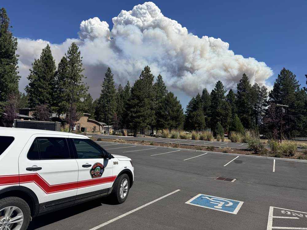
Wildfires have burned 1.5 million acres across Oregon this summer, nearly triple the state’s 10-year average of 640,000 acres for fire season.
“All this before we enter a dangerous time in the fire season” with east winds in September, said Oregon Gov. Tina Kotek.
Within days of Kotek’s comments, new large fires in Klamath and Grant counties caused evacuations.
Several other blazes started Sept. 2 in remote areas in Eastern Oregon, likely caused by lightning strikes.
“We know that we have lightning that went through the area,” said Carol Connolly, public information specialist for the Northwest Interagency Coordination Center, which facilitates wildfire suppression efforts for agencies.
Though many of those fires scorched remote land covered with grass and brush, Connolly said infrastructure for utilities and agricultural acreage could be at risk.
“It could mean somebody’s livelihood with their grazing permits,” she added.
Oregon’s 14th conflagration was issued Sept. 1 for the Copperfield Fire east of Chiloquin in Klamath County.
Gusts near 40 mph pushed the fire’s spread.
“The weather drove this fire and Oregon will continue to face challenging weather conditions over the next three weeks. Fire season isn’t over yet and I encourage everyone to stay vigilant,” Klamath County Sheriff’s Office Chief Deputy Travis Medema said.
As of Sept. 2, the fire had grown to 3,241 acres.
The morning of Sept. 3, Eric Perkins, Oregon Department of Forestry operations section chief, said crews had mostly lined around the blaze.
“The fire is actually in a really good spot,” Perkins said in a video update.
Evacuation notices remained in place Sept. 3 in areas between Chiloquin and the Sprague River.
Seven residences and 10 minor structures have been destroyed, and 20 more homes are threatened by the fire.
Grant County also had issued evacuation orders for residents due to the Rail Ridge Fire, which had grown to 7,748 acres by the night of Sept. 2.
The fire was reported south of Dayville earlier that morning.
This summer, agencies in Grant County battled seven fires simultaneously that scorched 170,000 acres, according to Grant County Emergency Management.
The Northwest Interagency Coordination Center was monitoring and agencies had resources at about 20 active large fires in Oregon Sept. 3.
Blazes that started Sept. 2 include the following (with grass and brush scorched, cause unknown, containment at 0% and no structures threatened unless noted):
• 778 PPR, 13 miles Southwest of Dayville, 3,015 acres burned.
• Butterfly Gulch, eight miles Northwest of Ontario, 312 acres burned and 40% contained.
• Jones, 10 miles east of Juntura, 3,800 acres burned, caused by lightning.
• Oak Canyon, six miles northeast of Tygh Valley, 5,000 acres burned, caused by lightning.
• Sage Hen, 10 miles west of Burns, 1,000 acres burned, caused by lightning.
• Shoe Fly, seven miles northeast of Mitchell, 8,000 acres of timber burned.
• Wiley Flat, 22 miles Northeast of Brothers, 5,000 acres burned.
Kotek spoke after visiting the Northwest Interagency Coordination Center in Portland Aug. 29.
Nearly 5,000 firefighters were dispatched to large fires across Oregon last week. At the peak of fire activity a few weeks ago, that figure was more than 10,000 people.
In response to the wildfires, Kotek has declared a statewide emergency, deployed the national guard, requested a secretarial disaster declaration for agricultural lands impacted by wildfire, requested and received seven Federal Emergency Management Agency grants and issued 14 separate conflagrations.
